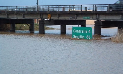
Flood Hazard & Risk Mitigation Studies
WEST provides services in hydrology, hydraulics, flood risk assessment, and floodplain mapping in river, estuarine, and coastal environments for local, state, and federal government agencies and private industry. WEST personnel are routinely involved in conducting analyses to delineate flood hazard areas, assessing impacts of proposed development on floodplains, and mapping of flood hazards.
WEST’s Flood Hazard & Flood Mitigation Studies services include:
- Water Surface Profiles
- Alluvial Fan Flood Hazard Assessment
- BFE Determination
- Coastal Flood Studies
- Floodplain & Floodway Delineation, Mapping, & Permitting
- FEMA Flood Insurance Study & No-Rise Certification
- FEMA CLOMR, LOMR & LOMA
- FEMA DFIRM Database & Map Panel Development
- Flood Warning Systems & Hazard Mitigation
- Risk & Uncertainty Analysis
Partial Client List
- Cowlitz County, WA
- Federal Emergency Management Agency
- Pinal County Flood Control District, AZ
- Transwestern Pipeline Company, TX
- U.S. Army Corps of Engineers, Various Locations

Featured Projects
- Camp Humphreys Flood Hazard Evaluation (Korea)
- Hydrologic and Hydraulic Modeling, FEMA Floodplain Remapping (CA)
- Interior Drainage Analysis for Scappoose Drainage District Improvement Company (OR)
- Flood Insurance Study and Flood Reduction Alternatives Analysis for the City of Turner (OR)
- Cactus Forest Flood Mitigation and Mapping (AZ)
- Risk Analysis of Proposed Modifications to Sacramento River Levees (CA)
